

Payette River Suspension Bridge, owned by the Idaho Northern & Pacific RR, spans the Payette River south of Smith's Ferry.

Photo of Payette River from suspension bridge looking northward.

Southward look of Payette River from the suspension bridge.

Mike's FJR1300AE, Grumbler's VN1500N2L, and Kurt's V-Star 1300. We met Kurt at the Chevron near Eagle earlier that morning, and rode out to the Longhorn Restaurant in Crouch for breakfast. Kurt had to return home to Boise after we split from the suspension bridge.

Serene part of the Payette River south of Smith's Ferry where the Cougar Mountain Lodge is located.

Rainbow Bridge over the North Fork Payette River facing north.

Looking south towards Round Valley while northbound on Payette River Scenic Byway to McCall.

Southwest side of Payette Lake by the public restroom facility in McCall.

45th Parallel Kiosk, located halfway between the Equator and North Pole, is a couple of miles north of New Meadows.

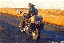
Grumbler following a semi-truck on US-95 just outside Riggins which is a whitewater rafting town alongside the Salmon River.

Time Zone Bridge where US-95 crosses the Main Salmon River a couple of miles north of Riggins. Mike snapped this shot from behind while riding north from Mountain Time to Pacific Time. We gained an extra hour of daylight.

Tolo Lake Mammoth replica located in Eimers Park at the Junction of Highway 95 in Grangeville.

We stopped near the junction of Mt. Idaho Grade Rd and SR-14 alongside the South Fork Clearwater River. SR-14 goes east to Elk City.

Rather than stay on SR-13 to US-12, we crossed this bridge over the Clearwater River from Kooskia onto eastbound US-12.

This bridge on Selway Rd by the Three Rivers Resort in Lowell is where the Middle Fork Clearwater River joins the Selway River and Lochsa River.

Cool '41 Ford Coupe at Mile Marker 97 on US-12 between Selway Road and Lowell.

Three Rivers Resort is on the south side of Lochsa River next to the Selway Road bridge.

Cougar Canyon Station in Lowell has fuel, convenience store, cafe, and whitewater rafting trips. Most of the other motorcyclists here were enroute to Sturgis. Met a couple from Watsonville, CA which is close to my old stomping grounds in Santa Cruz.

A straight stretch of that Winding Road Next 77 Miles from Lowell to Lolo Pass. That famous road sign just outside Lowell was removed for shoulder improvements that summer. Mike had been looking forward to taking a photograph of it.

One of the wood bridges spanning the Lochsa River west of Powell. Used by pedestrians and horseback riders to reach the trails.

Lochsa River from the wooden bridge facing east towards Powell. Was on this same bridge before during a couple of earlier road trips.

We took a butt break at the Loscha Lodge in Powell which is located roughly halfway between Lowell and Lolo Pass.

Grumbler riding up eastbound US-12 to the crest of Lolo Summit from Powell.

Lolo Summit is at an elevation of 5235' at the Idaho/Montana state line. Guess we were a month early and 203 years too late. ;^)

Missoula County, Montana. We followed that winding road, which went downhill, to Lolo Hot Springs.

Lolo Hot Springs Resort is on the left, but we were running late, and had to continue riding east to southbound US-93 in Lolo.

Final picture as dusk descended west of Lolo on US-12. After going through road construction on US-93, we arrived at the Super 8 in Hamilton. Checked in then walked over to Perkins for supper before calling it a night.

We got up early that morning and rode south on US-93 through Bitterroot Valley to Trappers in Darby for a big, home cooked breakfast.

Larger-than-life fabricated farm animals at an antique store in Darby. Never had the time to stop here for a spell -- it's a cool, interesting town.

Bitterroot River in Bitterroot Valley with the Bitterroot Mountains in the background.

We traveled south and ascended US-93 through the Bitterroot National Forest to the restrooms at Lost Trail Pass.

Chief Joseph Pass is just a couple of miles east of Lost Trail Pass via Highway 43.

Grumbler descending Highway 43 to the junction of US-93. Sign displays Missoula to the right and Salmon to the left. We turned left, and rode south to Salmon.

US-93 enters Idaho from Montana at Lost Trail Pass via tight, downhill switchbacks before it levels out.

Impressive looking bluffs towering above US-93 while southbound to Salmon for fuel.

We fell beind these two Harley-Davidson riders riding at a good clip between Salmon and Challis until we pulled over for a butt break.

Picturesque and curving stretch of US-93 in the canyons while enroute to Challis.

Northward view of US-93 and the river along a barren stretch while riding south to, you guessed it, Challis.

We blew through Challis and droned several miles south to see Grand View Canyon.

After riding through Grand View Canyon and back, we stopped here for another butt break before returning to Challis for yet another butt break at the restrooms and picnic area at the junction of SR-75.

Bighorn Sheep descend upon SR-75 (Salmon River Scenic Byway) right around here.

Salmon River Scenic Byway alongside the Salmon River is where it turns twisty.

Sawtooth Mountains overlooking a cattle ranch in Lower Stanley. One of the ranchers here owns the Bridge Street Grill which is popular with motorcyclists.

Mike Plant came all the way over from Gridley, CA for the Lolo Pass Loop. Early August tends to be too hot and dry. June is about the best month for this loop although I've done it as late as September.

Salmon River, Sawtooth Mountains, Salmon River Scenic Byway, and a FJR1300AE.

This is a great spot for photo ops. Would recommend parking just past that sign growing out of my gas tank when out this way. We went less than a mile from here to the Bridge Street Grill for bbq wings and cold ones.

SR-75 became Sawtooth Scenic Byway after Stanley. We turned onto Redfish Lake Rd.

We bypassed Redfish Lake Lodge and stopped at Redfish Lake in the Sawtooth National Recreation Area.

We returned to Stanley for fuel then followed Ponderosa Pine Scenic Byway west towards Boise.


We parked behind the Visitor Center at the junction of SR-21 and Main Street in Idaho City.

Welcome Vistor Center. That light blue building in background has a small visitor information center and public restrooms.

Calamity Jayne's is a cafe with a fenced patio area offering scenic views of the mountains.

Main Street looking east towards the Sinclair gas station on SR-21.

Grumbler riding west on Main Street to the Clutter House. Not sure what the locals call it, but it's cluttered looking.

Maybe it's designated as the Sluice Box. At any rate, it sure is cluttered-up. Have been inside before when it's open as an antique store.

Idaho City is a historic town from the gold rush days. These buildings have obviously been around awhile.

Skate Center in Idaho City. That hand painted sign has seen better days, but it's still cool looking.

We departed Idaho City, which doesn't have a lot of paved streets, for the Kodiak Grill on Highland Valley Summit to have dinner with Kurt and Connie.

Ponderosa Pine Scenic Byway is very picturesque and twisty between Idaho City and Robie Creek. We had dinner at the Kodiak Grill by ourselves as Kurt and Connie had to return home earlier than anticipated.

Photos and video by Mike Plant
No comments:
Post a Comment